Live Alpine outlook

SkiWeather.eu

Alpine ski weather, snow forecasts and resort conditions.

Compare Alpine snow depth, 48-hour and 5-day forecasts, regional weather, resort opportunities, anomalies and live mountain webcams.

Mountain intelligence52/100
Selective mountain window Lamoura · Compare resort altitude
Trend No net-change signal Best band Compare resort altitude
Live Alpine ski weather intelligence

Alpine ski weather & resort intelligence

A concise Alpine overview: what changed, where current evidence is strongest, and which deeper report to open next.

Summer mountain priorities
Summer mountainMountain weather window
Precipitation timing30% Visibility / cloud22% Wind exposure18%
Alpine decision support

No single Alpine region has a decisive advantage yet

Read the current signal, opportunity, caution and evidence separately before choosing a resort.

Current signal52/100Selective mountain window

Regional evidence is still thin or fragmented. Compare resort-level snow, weather and altitude rather than treating missing evidence as a negative signal.

What changedSince yesterday: lead changed from Saint Blaise to Lamoura

Use the change as a timing signal, not as a permanent resort rating.

Best supported opportunity100/100Chamonix Valley

Why it matters: exposed lifts, ridges and visibility can become less comfortable even when precipitation is limited.

Inspect
EvidenceConfidence building

Best band: Compare resort altitude · forecast leader: Lamoura

Current conditions can change quickly. Structural resort Fit remains separate from live opportunity.

Alpine situation now

Chamonix Valley leads the current resort set while regional differences remain local

French Alps: Altitude and local timing remain decisive · exposed lifts, ridges and visibility can become less comfortable even when precipitation is limited.

Best developing Chamonix Valley Promising mountain-weather window
Open full Alpine briefing →
Resort opportunities

Where the pattern creates the clearest mountain choices

Rank all resorts →
Regional contrast

How the regional setup differs across the Alps

Explore regions →
French AlpsLocally variable

No broad directional edge is strong enough; local exposure, altitude and timing dominate.

Lead resortChamonix Valley
Evidence +
Swiss AlpsLocally variable

No broad directional edge is strong enough; local exposure, altitude and timing dominate.

Lead resortLauchernalp Lotschental
Evidence +
Austrian AlpsLocally variable

No broad directional edge is strong enough; local exposure, altitude and timing dominate.

Lead resortStubaier gletscher
Evidence +
Transitions & hazards

Where conditions can change the mountain choice fastest

Open Alpine Watch →
Want the detail? How this Alpine read is built Signals, transitions and methodology
Current evidence first

Live and forecast mountain signals are kept separate from enduring resort Fit, so a short weather event cannot rewrite the resort itself.

Season decides relevance

Snow-memory and snow-caution signals are deliberately suppressed outside the winter decision season.

Missing is not negative

Incomplete evidence is not converted into an artificial zero or a hidden penalty; the interface simply avoids making a stronger claim than the available mountain signal supports.

Advanced context is optional: the main decision section above remains the primary reading path.Open methodology →
Conditions

Check the evidence behind the Alpine read

Snow, precipitation and temperature tables for verification.

High-mountain snow

Snow reports →

24hSince yesterday: little change

Leading current high-mountain snow report: Piau Engaly with about 350 cm on the upper mountain.

Why it matters

residual high-mountain snow can affect summer mountain conditions above 2,500 m, but it does not imply that ski terrain is open or skiable.

SkiresortSnow (cm)Temp (°C)
lowerupperlohi
Piau Engaly130350918
Lauchernalp7029925
Serfaus Fiss Ladis7240820
Kitzsteinhorn02351325
Sankt Christoph am Arlberg90225719
Zurs am Arlberg90225516
Engelberg02211018
Zugspitze190190-312
Molltaler Gletscher0180-28
Solden0174616
Sun, Sep 27

48h precipitation outlook

48h outlook →

24hSince yesterday: lead changed from Saint Blaise to Flekkefjord

Strongest visible 48h precipitation signal: Flekkefjord at about 58.1 mm.

Why it matters

a strong short-range precipitation signal can reduce visibility and mountain comfort; compare temperature and webcams before travel.

SkiresortPrecipitation (mm)Wet daysTemp (°C)
totalmax/day≥ 1 mmhi
Flekkefjord58.133.9227
Pas de la Casa4530217
Encamp4530217
Pradollano3938210
Sauda34.419.5212
Istanbul32.621220
Cerler2925220
Vall de Nuria28.416.4210
Saint Blaise26.423.6220
Narvik26.223.2210
Mon, Sep 28 – Tue, Sep 29

5-day precipitation forecast

5-day forecast →

24hSince yesterday: lead changed from Saint Blaise to Lamoura

Strongest visible 5-day precipitation signal: Lamoura at about 92.3 mm.

Why it matters

multi-day totals reveal persistent wet patterns and help separate one short event from a broader unsettled period.

SkiresortPrecipitation (mm)Wet daysTemp (°C)
totalmax/day≥ 1 mmhi
Lamoura92.368316
Les Rousses9268317
Sauda8340.5513
Sankt Anton am Arlberg74.336517
Hirschegg74.236418
Bach im Lechtal74.136420
Riezlern73.936419
Stuben am Arlberg73.336415
La Joue du Loup73.256.1315
Lech am Arlberg73.136417
Mon, Sep 28 – Fri, Oct 2
Plan the mountain window

Go deeper into the Alpine weather

Regional weather, maps and webcams for the next mountain window.

Snow science

Understand the mountain weather

Context for Alpine weather, snow signals and mountain planning.

Snow science

A smarter way to choose where to ski

Choosing a ski resort has always involved compromise. Snow matters, but so do terrain, altitude, lift infrastructure, travel time, resort size, family suitability and the kind of trip you are planning. A destination that is excellent for a week…

Read snow insight
Live mountain check

See what the mountain looks like now

Current mountain views, prioritised by relevance and freshness.

Forecast maps

Explore the Alpine weather pattern

Compare precipitation and mid-mountain temperature before opening the full maps.

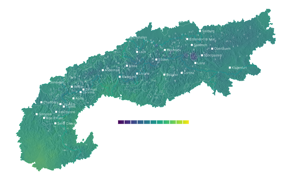
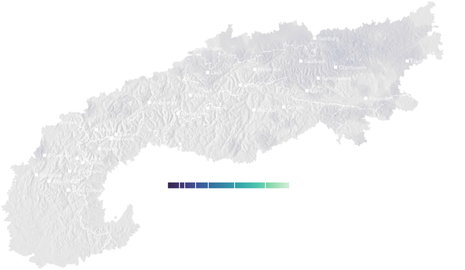
Precipitation forecast map for the Alps for Mon, Sep 28 Daily total
Mon, Sep 28Precipitation
Strongest visible short-range signal: Flekkefjord · 58.1 mm. Use the map to see whether it forms a broad Alpine pattern or a local hotspot.
↗
Temperature forecast map for the Alps for Mon, Sep 28 Mid-mountain max
Mon, Sep 28Temperature
Mid-mountain temperature separates cooler Alpine sectors from warmer valleys and helps explain where precipitation feels most disruptive.
↗