Resorts in close proximity of Glacier de Saleina.
SkiWeather.eu snow report
Glacier de Saleina snow report
Valais, Switzerland, 2800m
Upper snown/a
Fresh snown/a
Slopes open32%
Lifts open55%
Latest ski condition
Lower and upper-slope snow depth trend.
Recent snowpack movement with fresh-snow alert bars for Glacier de Saleina.
Use the chart to compare base depth with recent fresh-snow signals before choosing terrain.
Integrated snowpack, fresh-snow, operation and thermal assessment.
The interpretation combines the same normalized snow facts used by the depth, slopes and lifts cards, then applies freshness and contradiction checks.
Lower snown/a
Upper snown/a
Fresh snown/a
Mountain access42%
Snowpack data limitedLimited mountain accessFresh snow unavailable
A reliable upper-slope snow-base assessment is not available. A reliable fresh-snow amount is not available in the current resort sources. Mountain access is limited; verify the exact open sectors before travelling. Temperatures remain at or below freezing, supporting firmer snow preservation where wind is not stripping the surface.
Measured lower, middle and upper-slope snow depth.
Current snow depth by terrain band, with upper slopes carrying the main snowpack signal.
2800mMiddleUpper
Fresh snown/a
Freezing leveln/a
Snowpack data limitedFresh snow unavailable
A reliable upper-slope snow-base assessment is not available. A reliable fresh-snow amount is not available in the current resort sources. Temperatures remain at or below freezing, supporting firmer snow preservation where wind is not stripping the surface.Five-day fresh-snow signal by altitude band.
Forecast accumulation is split by lower, middle and upper terrain to show where the snow signal matters most.
2800mMiddleUpper
Useful refresh
Useful snow cycle: expect a meaningful upper-slope refresh. Check lift and grooming updates because the first usable terrain may be selective.Open slopes
Open ski terrain today.
Operational terrain share from the latest snow report.
Open share32%
Slopes open9 of 28
Limited terrain
32% of slopes are reported open. Terrain availability is restricted.Open lifts
Lift operation today.
Operational lift share indicates current access and terrain reach.
Open share55%
Open lifts6 of 11
Partial access
55% of lifts are reported open. Lift access is partial and some links may be unavailable.Current weather facts for the resort.
A concise snapshot of temperature, precipitation, wind and freezing level; practical consequences are kept in Weather impact.
Weather
Sleet
Temperature
-5 to -1 °C
Precipitation
29.7 mm
Wind
8 km/h
Chance of precipitation
100%
Evaporation
0 mm
Heavy precipitationCold mountain day
Heavy precipitation is likely to dominate the day, with cold mountain temperatures and light winds.
Today’s period-by-period forecast.
Use the visible period cards to identify timing, temperature changes and the most likely wet or dry window.
Loading period forecast…
Wettest: MorningFog: EveningPeak: Morning
Morning: heavy rain, around 20 mm at about -1 °C. Afternoon: snow showers, around 1.4 mm at about -3 °C. Evening: light rain showers, around 2.7 mm at about -5 °C. Precipitation develops in the morning, peaks in the morning near 20 mm and eases by the evening. Temperatures fall by about 4 °C from morning to evening.
Tomorrow’s period-by-period forecast.
Use the visible period cards to identify timing, temperature changes and the most likely wet or dry window.
Loading period forecast…
Wettest: MorningPeak: Morning
Morning: snow showers, around 4.4 mm at about -5 °C. Afternoon: snow showers, around 1.7 mm at about -6 °C. Evening: snow showers, around 0.8 mm at about -6 °C. Precipitation develops in the morning, peaks in the morning near 4.4 mm and eases by the evening.
Snow accumulation
Current modelled snowfall signal.
A model map gives spatial context for today’s fresh-snow opportunity; local value still depends on altitude and exposure.
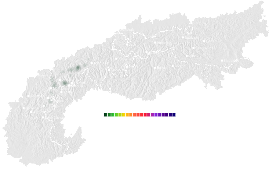
Modelled snow signal
Use this as a regional opportunity layer, then verify with resort-level depth, forecast and open-terrain data.Three-day accumulation
Short-range snowfall accumulation.
Three-day accumulation helps identify whether a single snow pulse becomes a useful short-range snow cycle.
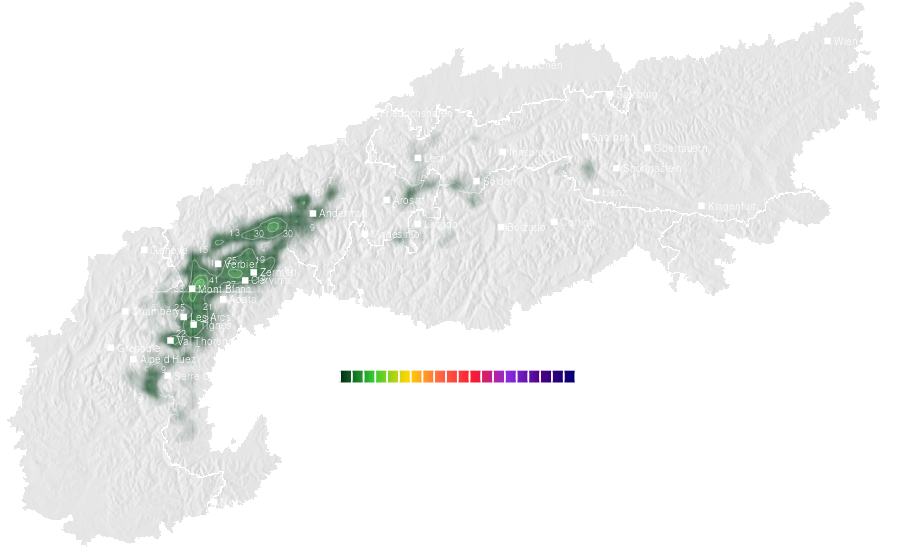
Short-range snow cycle
Use the map to compare regional snow potential with local upper-slope depth and current operations.Regional snow forecast around Glacier de Saleina.
Compare the same five-day snow signal across nearby resorts to separate a local forecast from the wider regional pattern.
Regional comparison
Compare neighbouring areas before treating one resort forecast as representative for the whole region.Snow depth ski season 2025-2026
Current season snowpack history.
Snow depth development through the active ski season.
Snow depth previous ski season 2024-2025
Previous season reference.
Snow depth from the previous ski season for comparison.
Detailed historical snowResorts with comparable elevation and long-year weather profile.
Use comparable resorts to judge whether snow depth and short-range snowfall are typical for this elevation and climate setting.
Related resorts are temporarily unavailable.
Continue your resort check
Terrain, snow and weather for Glacier de Saleina.